The tour literally starts behind IKEA in Bergen. Doesn't that sound promising?
3 comments
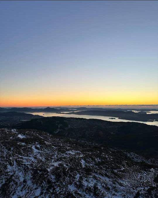
The tour literally starts behind IKEA in Bergen. Doesn't that sound promising? Think again. This beautiful area of small hills has escaped development in the larger Åsane region and is one of my favorite places for a quick but spectacular hike. Also check out "Veten" on my wikiloc: another great trip to this area. This trip will take you 3 hours if it will be filled with many things western Norway has to offer tourists:
beautiful farms, spectacular lakes, rugged moors, high peaks and, last but not least, at least, the view of the fjords. Take the well-marked path from the Baugtveit car park and follow the farm. Here the trail climbs up to the lake and continues through the pine trees. After 10 minutes, you'll appear on top of a covered mountain. Follow the path to the right and climb Høgstefjellet. The descent is small, so you can get wet.
In the spring, this part is covered with flowers. One of the mountains near Åsane. It's amazing how close this small remote valley is to the sprawl of suburbia. Park your car in the designated parking area (entry parking) in front of the hamlet of Baugveit and start walking along the road. Follow it until the wide walkway leads to the side of the red building. Follow it up and reach the reservoir. Here the trail narrows and enters a pine grove as it climbs steeply. Go through the forest, climb the Televikkafjellet mountain and get a view of Knarvik and Lindås. Have fun again with the final climb to the top of the mountain. There you can also admire the islands of Sotra, Askøy and Holsnøy. From here the route descends back to Baugveit and choose a leisurely walk through one of the beautiful valleys in the Bergen region.
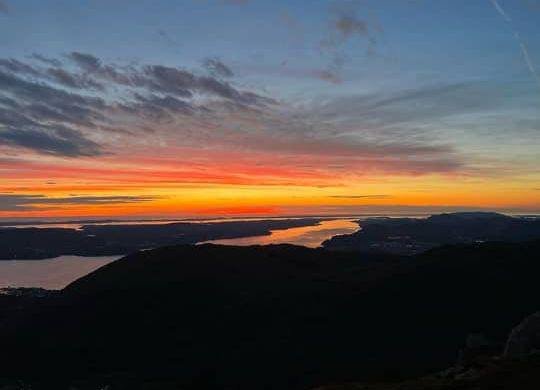
Just a few kilometers from the highway, it is almost unbelievable that this area has escaped "development". The beginning of the walk is a bit tricky: you have to cross the fields behind Jordalsveien 322 to reach the old road that goes uphill. After about five minutes, you pass the ruins of an old building on your left. Walk a little further until the path splits and you reach a pine grove.
The "level" path crosses a muddy area above several trees and turns left behind a barbed wire (to join a busy road for about 10 minutes: follow it to right if you will come this way). However, I improvised a bit, walking in the forest and walking in the forest under the power line. Don't be discouraged: you will reach the right path after about 10 minutes. Now the interesting thing: you leave the forest and enter an alpine pasture with a spectacular view of the valley below. Enjoy the view and visit Stallane, a former mountain tower that was inhabited until the mid-1950s. The house serves as a food stop during many weekends: if the flag is flying (you can see it from the bottom of the valley), it is open.
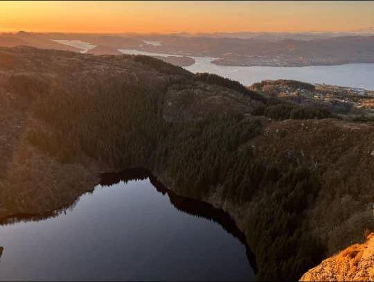
After Stallane, the path begins to descend slowly, following an old dry stone wall. Before you know it, it enters another pine tree and zigzags toward the valley floor. Literally, walking in the park ... in the city of Bergen. And even without the added benefit of finishing downtown with a latte or beer, this trip is awesome on its own. The Ulriken cable car takes you to the start and offers spectacular views of the Bergen skyline and the sea beyond. Once at the summit of Vidden, there is virtually no elevation gain to be gained.
The first part of the trek takes you through the flat tundra with snowy mountains in the background. In the middle, there is a short descent but it goes down to the lake Svartediket. Then we climb again to the TV tower Rundemanen and across Floyen. The landscape now consists of old pine and blueberry undergrowth. If you still have energy left on the Floyen side, you can head down to the historic town of Bryggen for yourself. However, taking the funicular is probably a much more beautiful option now... A great walk after work or after a visit to the city center.

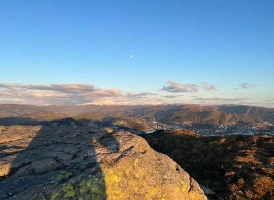
The terrain is simple and covered in open forest, offering views of the sea and the Ulriken mountains. Nubbevatnet has some nice picnic areas and there is even a house at the end of the lake which seems to be open seasonally (google Baunehytten). The back road takes you on a rough but very nice gravel road through a pine forest. One of the 7 mountains (syvvfjell) of Bergen and easily accessible from the city center.
An oasis of peace and quiet: park your car (or get off the bus) at Melkeplassen, walk about 100 meters up the hill, take the marked path and leave the world behind. The sound of the road fades into the background and is replaced by the sound of a running stream. In total, this trip represents about 300 meters of high gain, but you hardly notice it. The road climbs gradually (except for a small
Comments